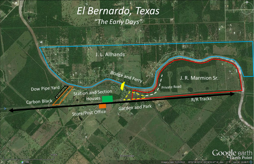
East of Sweeny about a mile or so as the train runs and between the communities of "Dog Town" and "Shady Acres" on County Road 334 sits the little community of El Bernardo. Once called San Bernardo in the early days, Marmion for a half of year before settling on the name El Bernardo in 1926.
The St. Louis Brownsville Mexico Railway began running thru the area in 1905-1906 and for about a mile and a half stretch the railway parallels the beautiful San Bernard River which provided a perfect setting for a community to develop and thrive. Early records confirm the river was called the "Rio Bernardo" and "San Bernardo" prior to becoming the "San Bernard" thus the "Bernardo" part of the name.
One of the first persons to acquire land in this area, carved out of the John Cummings League, was a fellow named James Richard Marmion Sr. who in 1907 bought 335 acres sandwiched between the river and railroad tracks. As a real-estate man with mining interest in Mexico he went on to buy more land in the area as well as land in other parts of the county.
In a 1910 court case titled "A J Bonds vs. Unknown Heirs of John Cummings (deceased)", Bonds was awarded 612 out of a disputed 665 acres. The remaining 53 acres was split amongst six parties, however Bonds later acquires most of those 53 acres. Bonds also had other acreage of undisputed land at this time.
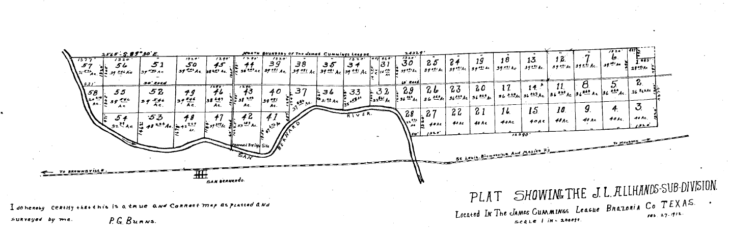
In 1910 P. G. Burns buys land on the opposite side of the river in a sub division being developed by J. L. Allhands. Allhands was pushing the county for a road from Brazoria to his sub division which he succeeded in getting around 1911. He also files a plat on the sub division in 1912 showing a proposed bridge across the river.
The St. Louis Brownsville Mexico Railway buys a 50’ wide by 600’ strip of land in 1912 for a spur track. The exact location of the spur is not clear but it is known the railroad built section houses for its workers and a flag station next to the track. The flag station was named "SANBERNARDO" which confused some Mexicans heading south to San Benito in the valley causing them to depart the train early.
Several people purchased land in this area on both sides of the track. Among them were J. D. Kuhn and L. G. Frisbie who together bought 640 acres in 1912 from Bonds, later incorporating into "The San Bernard Improvement Company", primarily for tax avoidance. Visions were high; 100 acres of potatoes the first year, cotton and corn crop the next, after clearing land, and a potential for a town site and rail shipping point. Kuhn also builds a store on the opposite side of the tracks from the river.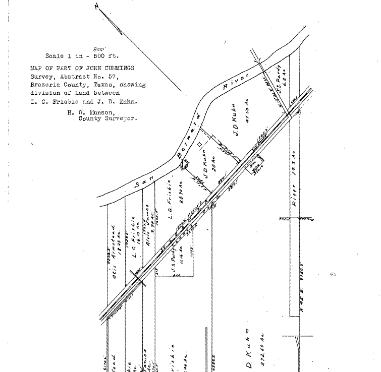
Like so many other places along the San Bernard River there was the need to cross it. The county was petitioned for a bridge perhaps as early as 1912 but definitely by 1914. In 1916 P. G. burns was awarded a contract to build a draw bridge on creosote piling. The bridge was built and accepted by the county in July 1916 and became known as "The Burns Bridge". (see specs)
This was not the first bridge built across the San Bernard in these early days only one of eight or so in Brazoria County, all of which were either draw bridges or swing bridges with the exception of the two pontoon bridges, one at Churchill and one at Blacks Ferry built in the 1940’s. Each bridge had a "Bridge Tender" with the responsibility to keep the bridge lighted, in working order, limit the amount of traffic and keep driftwood from stacking up against the bridge. The draw or swing bridge design indicates more boat traffic than one might imagine during this time period. Coupled with the road from J. L. Allhands sub division into Brazoria and wagon roads into San Bernardo, at the time, the bridge offered another route from the west side of the county into the bustling town of Brazoria. The bridge also tied the two communities on opposite sides of the river together.
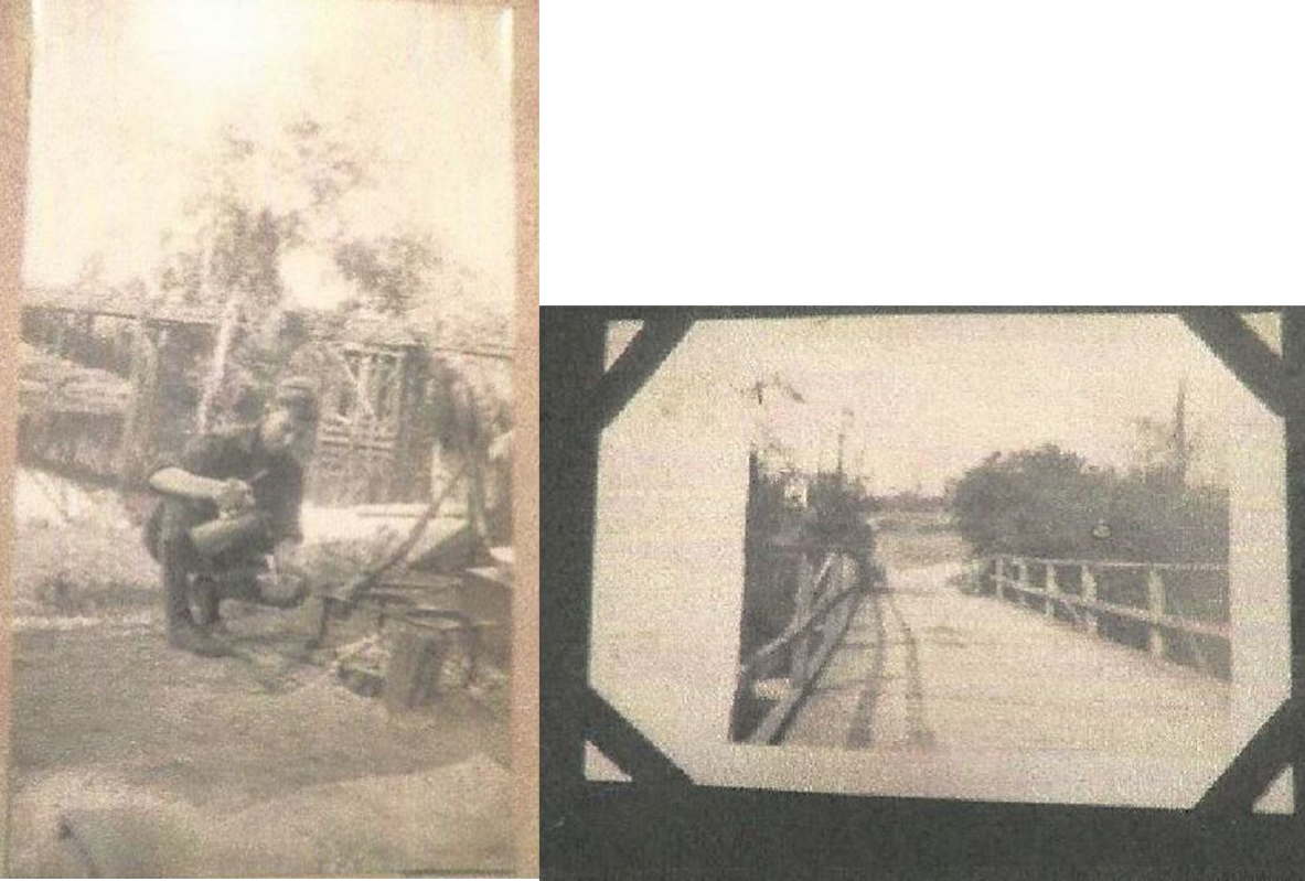
"The Burns Bridge" Most likely the bridge tender Image courtesy of Charlene Finley
By 1918 the little community was thriving as can be seen in the following newspaper clippings and pictures. Jacob Acord re-opens a store in the Kuhn’s building. They have a mayor and council, are expecting to re-open the post office which was closed in 1917, they have a school on the Brazoria side of river and the cat fish are biting. The post office was reopened in 1918 located in the store. Beginning in 1915 J. S Purdy buys property on both sides of the tracks and by some accounts brings in lumber by rail to build a beautiful river front home, later becoming the Issac’s, which still stands today.
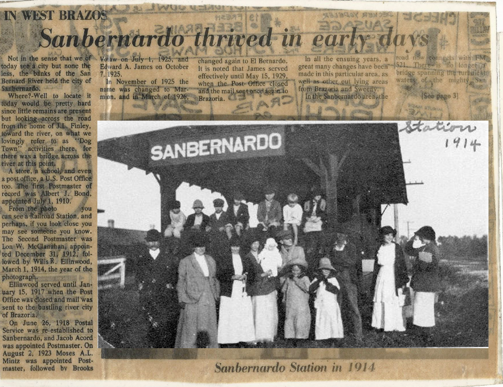
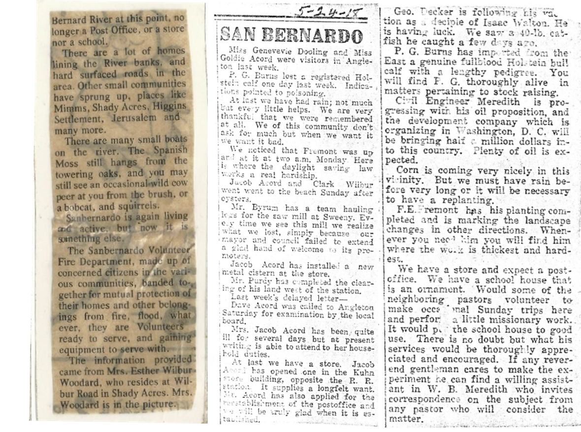
Newspaper clippings courtesy of Charlene Finley
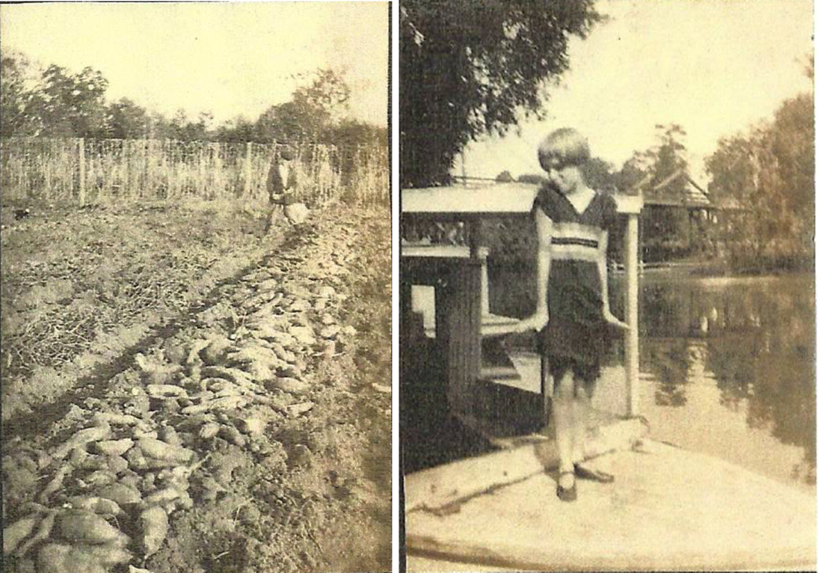
Potatoes
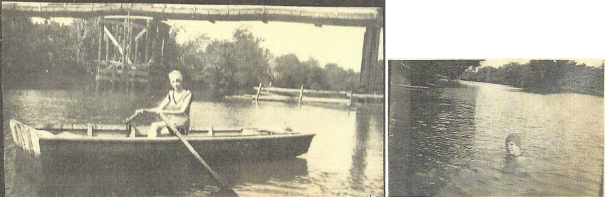
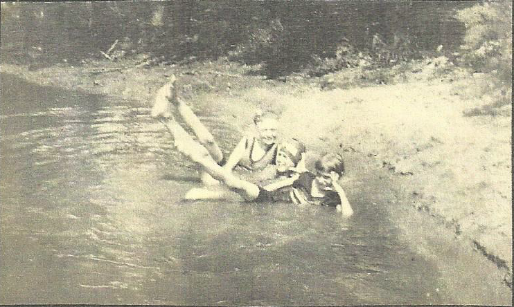
Boating, swimming and frolicking very much like a summer day today.
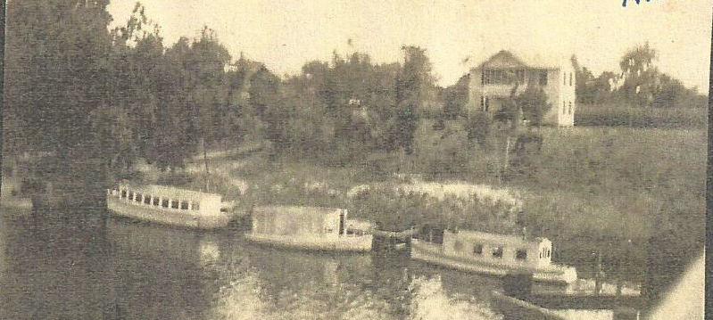
Purdy house in background.
Images courtesy of Charlene Finley
Locals during this time period referred to an area between the tracks and river as a park with rose gardens, perhaps this could be the orchards mentioned in the 1911 San Bernard Land Development Sales Brochure.(see brochure here) John Hammons had this area around 1930, or before, along with several cottages on the river, where people came to stay while they fished and hunted.
There is no recorded evidence that J. R. Marmion lived on or did any development with his property until around 1922 when he buys 25’ right of ways for private road into his land from two land owners with property between his and the county road leading to the bridge. In 1924 he sells a small piece of his river front property to another person but again retains access right of way into his property. This could be the time he develops this property into his family retreat and some say a summer camp.
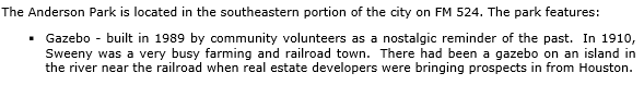
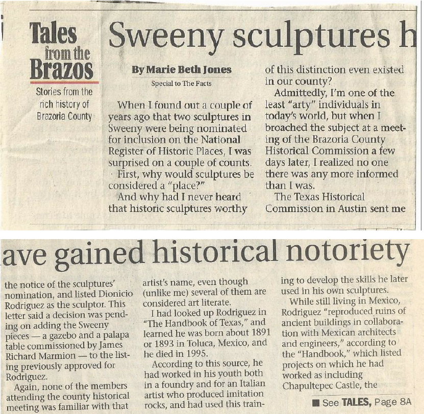
In 1926 J. R. Marmion Sr. commissioned Dionicio Rodriquez, noted for his concrete structures resembling wood, to build two faux wood structures on his property. One of which is a gazebo built on an island in the largest of three ponds and considered one of Dionicio Rodriquez’s best, the other a palapa near the river bank about a quarter of mile away. Both of these were awarded the National Register of Historic Places designation in 1991 and both are standing today thanks to current property owners. One of the property owners have now added their twist to the history by moving in and renovating a 1949 caboose with visions of adding a depot. The gazebo also inspired Sweeny community volunteers to build a gazebo in "Anderson Park", although the history is open to discussion.
From "The City of Sweeny" website;
A web search of "Dionicio Rodriquez" or the book "Capturing Nature" by Patsy Pittman Light are two ways of finding more information about Rodriquez and his work.
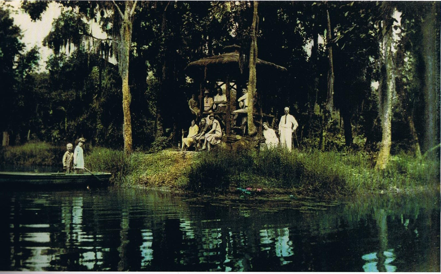
Marmion Retreat and Gazebo. Most likely J. R. Marion Sr. on the right.
Image from the book "Capturing Nature" by Patsy Light
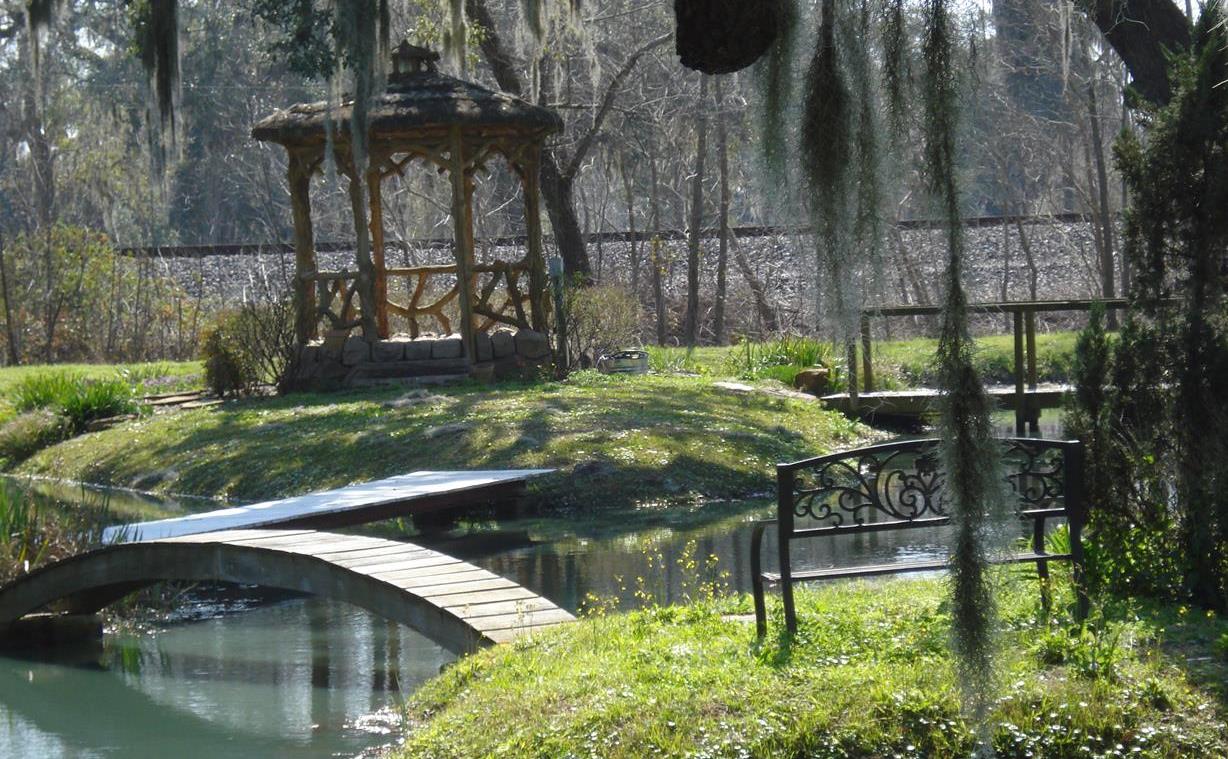
The Gazebo as it is today.
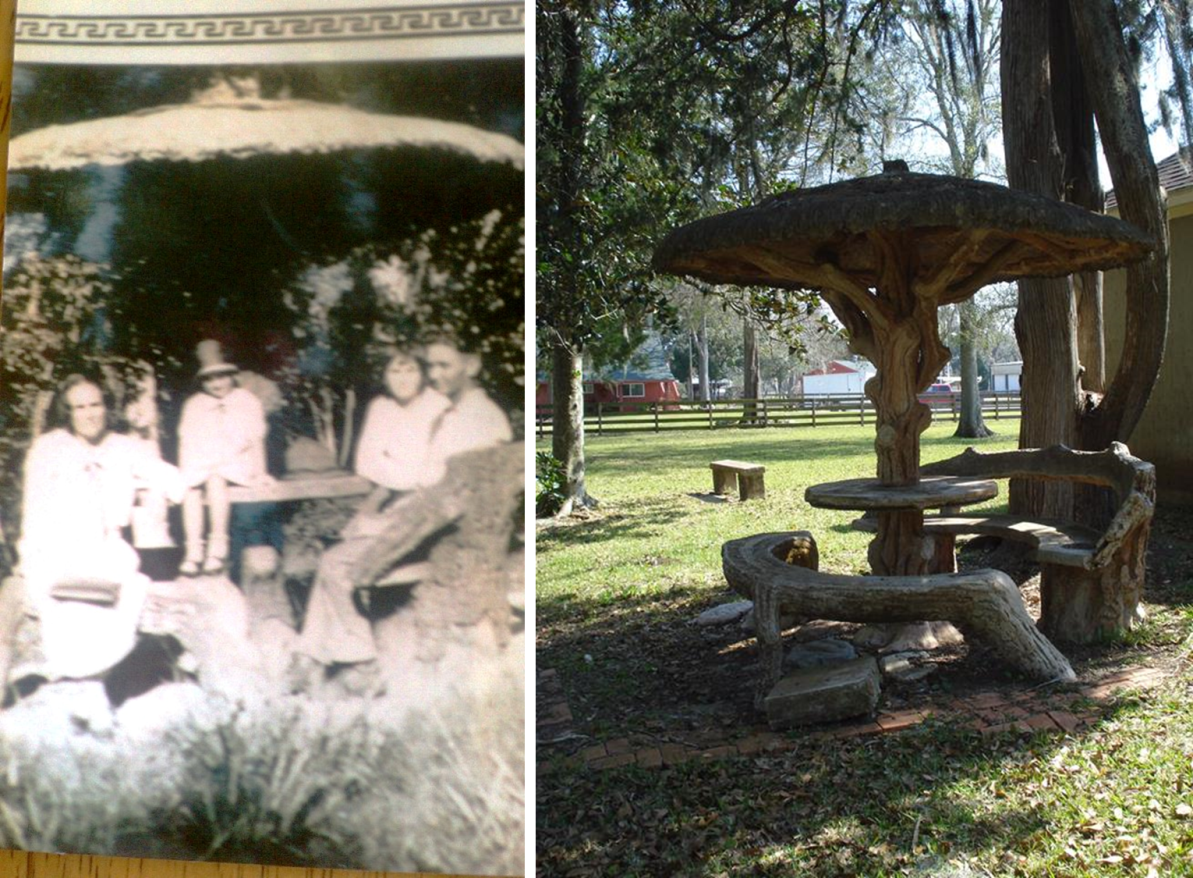
The palapa in the late 20s, Ada Finley on the left and Eula V Boyd to her left The palapa as it is today.
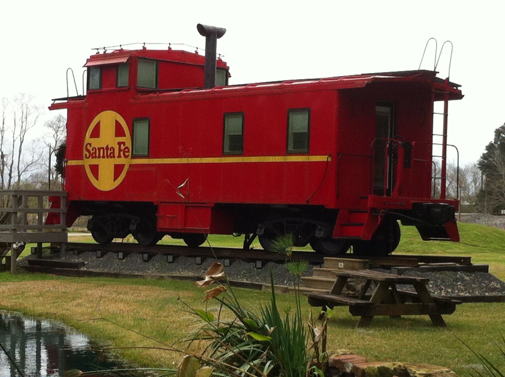
1949 Santa Fe Caboose renovated into a guest quarters as a new twist to El Bernardo history.
In 1926 J. R. Marmion Sr. and wife Bula gave to their minor son James Richard Marmion Jr., by deed, the western nine acres of the property. After the passing of J.R. Marmion Senior in 1935 and Bula in the mid-1940s followed by probation of wills and a partition agreement, J. R. Marmion Jr. receives another one fourth of the original 330 plus acres adjacent to the nine acres. J. R. Marmion Jr. and wife Jean had three children who went to school in Sweeny thru 1957. Around the mid-50s, they start selling the nine acres as river front lots thus was the beginning of the "Riverbend" section of El Bernardo. James Richard Marmion Jr. died in 1994, however his family retains part of this property today.
In 1927 "The Burns Bridge" was damaged, most likely from high water or storm. Since the county approved repairs it was repaired and its use continued. However in the 1930-1931 timeframe the bridge was destroyed by another storm. Petitions to the county to rebuild were filed and investigated but apparently not approved so the communities on both sides of the river were without a way to cross until a ferry began service in 1936. During this time Britton Sewell used a row boat to ferry people across the river. In 1936 W. M. Dodds, from across the river, applied for and obtained a license to operate a hand pulled one car ferry. Exactly how long the ferry operated is not known, but there are some recorded indications it could have been into the 1950’s.
In the 1940’s, the booming oil and gas industry also had an impact in El Bernardo. Peerless Carbon Black Company, later becoming Columbian Carbon Black Company, opened a plant around 1946 and operated it until mid to late 50’s. Abercrombie, Dow and Phillips all bought pipeline right of ways thru the community and in 1950 Dow Chemical leases and then later buys a few acres to use as a pipe lay down yard. Locals
hauled surveyors into the woods with their wagons for oil and gas exploration purposes.
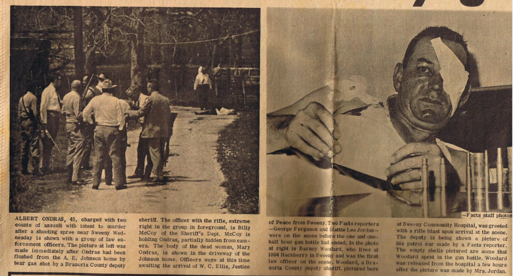
Oh, there have been some shadowy days such as when a gun standoff took place in the 60’s and the police considered using a dozer blade as a shield before settling on tear gas and a reported raid on a "moonshine still" back in the earlier days.
Today there is no ferry or bridge, no industry, no store or post office, no school and although not proven, probably no moonshine still. However, there is no question El Bernardo became and continues to be an important part of Sweeny area history and a little community with its own prominent people and rich history. From farming and ranching, to water recreation and river front houses both full time and weekend to just a nice country setting for living and raising a family.